Quiberon-Houat – 19/21 avril 2014 – wind 3bft, NE then West, then SouthWest – magnitude of tidal fluctuation : 87-66
This article deals with both a seakayak trail and a walk around Houat island in southern brittany.
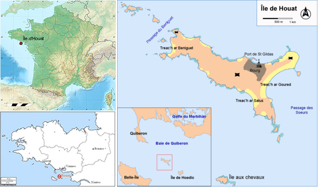
Houat, one of Morbihan’s islands, hyphen between Hoedic and Belle-Ile islands, offers great variety of landscapes, between dunes and cliffs.
All around Houat you’ll find magnificent beaches as great areas of whitish sand or tiny ocher coves surrounded by cliffs.

Houat island in southern brittany
For easter week-end, leaving from the pointe du conguel in Quiberon, tidal hours were favourable for a crossing with ebb and a return two days later with flow.
On our way to houat, La Teignouse’s lighthouse is a good point of reference to confirm the compass direction to take.
A brief stop on « chaussée de béniguet » is welcome, then after having crossed the « passage du béniguet », we reach the westerly houat’s islets. We follow the wonderful and wild south (western) coast, with great navigation between rocks, and finish the navigation on a beautiful beach facing « ile aux chevaux ».
Next day a walk round the island offers beautiful landscapes. Northern coast is greener (filled with flowers) than south coast, much more rocky and dry.
Third day it’s time to paddle back, paddling along Houat’s north coast, then following our way back, with the flow.
You can see some photos in the bellow article, thanks to Laurent for photos and translation.
Guide : Sea kayaking Guide Brittany
Tidal streams : SHOM Courants de marée Côte sud de Bretagne, Audierne au Croisic
Nautical chart : SHOM 7033 De Quiberon au Croisic 1:50 000
Wind : Quiberon
Swell : Previmer
Tidal hours : Port Navalo
